Every part of the workflow gets faster, more consistent, and easier to deliver.
Tape measure estimates
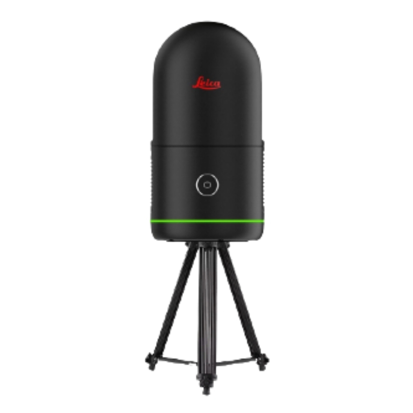
LiDAR-precise tree data
Tree-level measurements captured with accuracy, not approximation.
Automatically generated for every plot
No manual calculations. No missing parameters. Every scan produces a complete, standardized dataset.
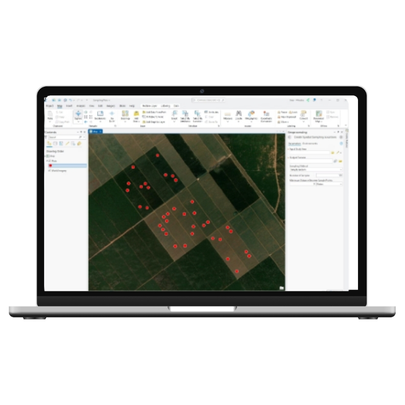
Three integrated layers. One system.
No more switching between field tools, spreadsheets, and GIS software — DFI handles it all.
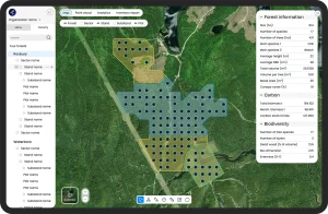
Digital Forest Mapping
All inventory data is stored within a GIS-based environment, linking plots, stands, and key statistics in one system.
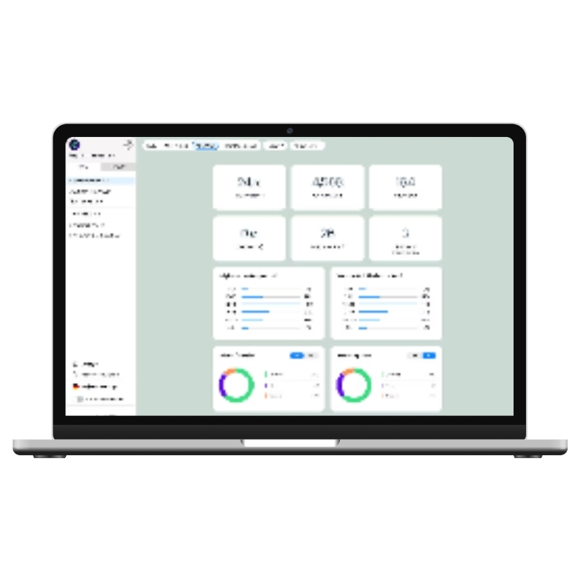
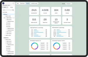
Analytics & Reporting
Standardized datasets and flexible parameter combinations support reporting, documentation, and long-term comparison.
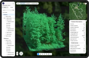
Point Cloud Visualization
Each plot includes a LiDAR-based 3D representation, enabling virtual review of forest structure and stand characteristics.
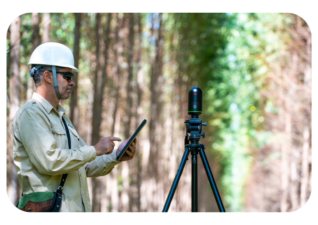
DFI wasn’t designed in a boardroom — it was built through real inventory work in large-scale plantation forestry, then refined with leading researchers.
Built in the field. Validated by science.
Field-Based Development
DFI was built based on extensive forest inventory fieldwork in industrial plantation forestry in Brazil, ensuring the system reflects real operational conditions.
Scientific Collaboration
The platform integrates methodologies developed together with forestry experts and academic researchers, combining practical field knowledge with scientific expertise.