For Inventory Companies


What is DFI?
DFI, Digital Forest Inventory, is the LiDAR based platform developed by 44moles for digital forest inventories in large scale plantation environments.
Using MLS and TLS scans, DFI delivers precise tree level data including species, height, diameter DBH, and volume. The platform transforms raw scan data into decision ready results.
Designed for inventory companies and forest managers, DFI supports efficient planning, reliable reporting, and data driven forest management.
Who is DFI for?
DFI by 44moles enables professional inventory companies and forest managers in Brazil to work with accurate consistent and comparable forest data.
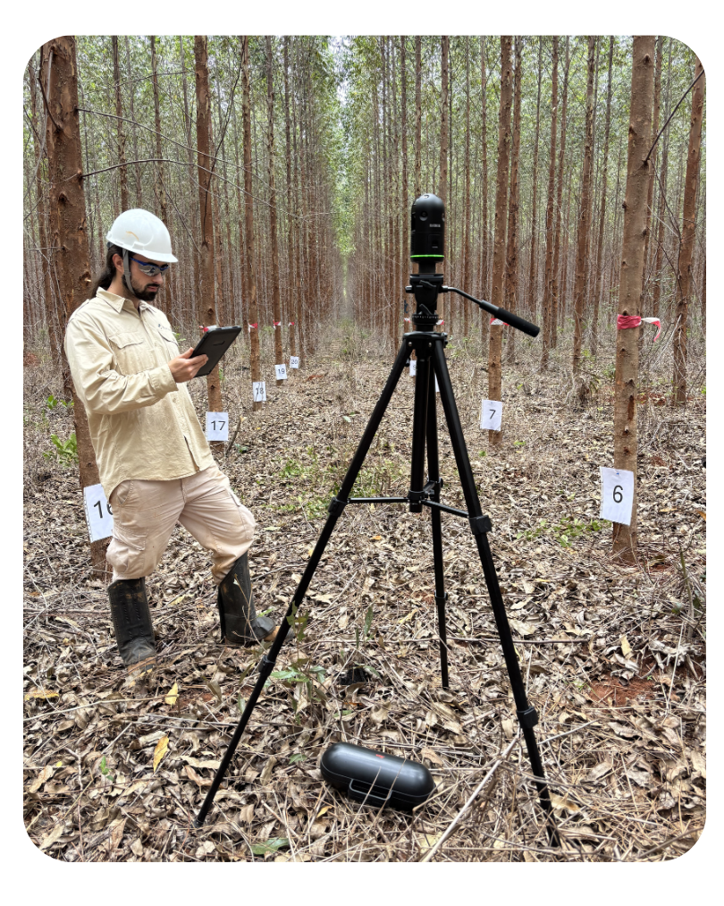
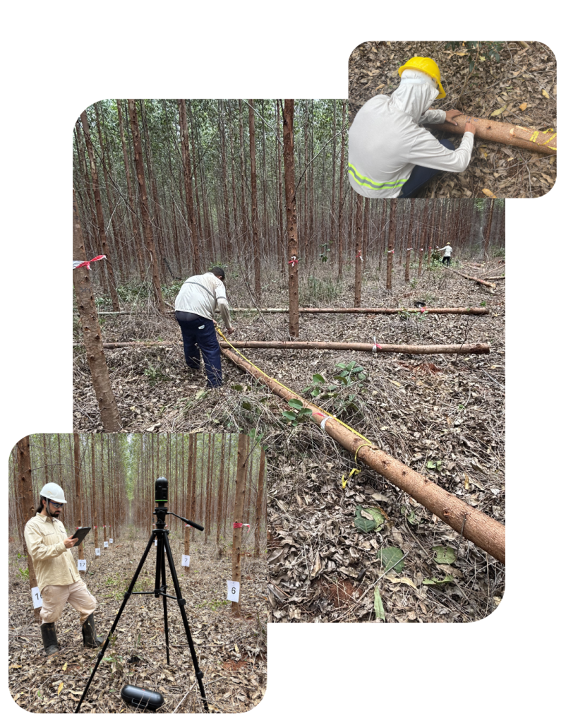
Field Worker
For Inventory Companies
Benefits:
- Accurate and repeatable tree-level measurements.
- Consistent stand-level metrics across projects and inventory cycles.
- Standardized field data collection procedures.
- Reduced manual data processing effort.
- Structured digital outputs for further analysis and reporting.
Core Functions:
- Smartphone-based field application for sampling plot management.
- Integrated tree measurement and scanning module.
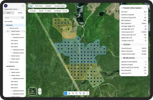
- GIS dashboard with configurable map layers.
- Shapefile import, export, and creation.
- Automated sampling plot generator.
- Offline data capture with synchronized data transfer.
- GPS-based plot positioning and navigation.
Forest Manager
For Forest Owners and Managers
Benefits:
- Structured overview of forest assets and management units.
- Comparable inventory data across time and locations.
- Centralized digital access to all inventory information.
- Data suitable for planning, reporting, and documentation.
- Reduced data fragmentation across systems.
Core Functions:
- LiDAR-based digital forest inventory processing.
- GIS dashboard with configurable visualization layers.
- Interactive maps (forests, sectors, stands, plots).
- Forest parameter analytics and aggregation tools.
- Shapefile import and export.
- User and role management.
- Inventory planning and management tools.
Scientific & Technical Foundation
Field-Based Development
Based on extensive forest inventory fieldwork in plantation forestry.
Scientific Collaboration
Developed in collaboration with forestry professionals and academic researchers.
Institutional Partnership
In cooperation with the University of Göttingen, Germany.
Key Modules of the DFI System
The DFI system connects LiDAR-based field measurement with digital forest data for reporting, planning, and long-term management.
Digital Forest Mapping
All inventory data is saved within a GIS-based environment, linking plots, stands, and key statistics in one consistent system.
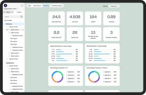
Analytics & Reporting
Standardized datasets and flexible parameter combinations support reporting, documentation, and long-term comparison.
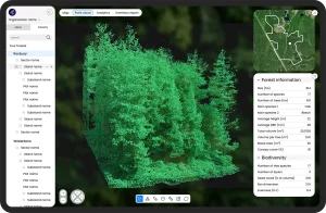
Point Cloud Visualization
Each plot includes a LiDAR-based 3D representation, enabling virtual review of forest structure and stand characteristics.
Shaping the Future of Digital Plantation Management in Brazil
- Preferential launch conditions
- Priority onboarding and implementation
- Direct collaboration with our product and development team
- Strategic visibility as early digital leaders in the Brazilian plantation sector
The Future of Plantation Inventory Starts Here
Forest inventory is no longer just measurement. It is infrastructure.
If you are preparing to modernise your plantation operations, we invite you to start the conversation.

- Ana Isabella G. Ferreira
- GIS and Remote Sensing Expert
- guimaraes@44moles.com
- +49 551 2707 9800